We end our walk at Dunwich, where Florence meets us and drives us back to the starting point at Aldeburgh. After 15 miles walking, getting in and out of cars can be slightly problematic, and arriving at the car park, I send a message enjoining my legs to struggle out of the seat, to which they respond, in a limited way, and I hobble stiffly towards my own car, groping in my pockets for a car key.
I grope again, try another pocket, and then another. And then another. I grope for a considerable time because I’m wearing cargo pant-type trousers that have eight pockets in them. I know this because I go through all eight pockets systematically three times, making twenty four times in all, I do this with increasing desperation, and on each of those twenty four occasions, I do not find a car key. ‘’Try the ones with the zip’’ says Florence, encouragingly. I already have, and I do again, but deep in my heart, I know I did not put the key in the zipped pocket, for it would probably still be there. I suspect that I put it in the insecure back pocket, the one that sheds small change with regular profligacy, usually within the confines of the car, invariably all over the bedroom floor when I’m taking off the offending trouser, but not, until now, has it shed car keys, and neither, until now, shed anything over a theoretically-possible 15 mile stretch of the Suffolk coast.
This happens, of course, at the end of our walk. At the start, optimism is the key note, as we head across a golf course with no right of way aiming for the footpath that by-passes Aldeburgh town to take us to the coast. Golfers are not famous for their commitment to open access, and golf balls can impact significantly upon the human skull. A (cautious) hats off then to the players on this particular course who are thoughtful and courteous to us intruders, greeting us in a most friendly manner and warning us of danger from their colleagues who are in the process of driving from the tees. I am also impressed that golfers are expected to rake their own bunkers, after they have fluffed their shots out of them.

Secret Informant picks up a tee from the ground, remembering an uncle who used to stick golf tees into the punctured tops of condensed milk tins to prevent the milk congealing. When Secret first saw them used for golf, he thought it was a particularly creative use of condensed milk stoppers (bless him!) and was thus inspired to become an engineer.
The Red House Studio Is famous as Benjamin Britten’s workshop. It has signs outside saying ‘Beware of the Dog’ in at least six different languages, including Greek and Russian, unusual in my experience of English tourist destinations, and saying something about Britten’s international reach.

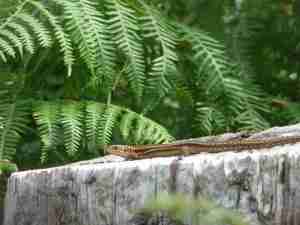
Crossing the Aldeburgh/ Leiston road we see a Grayling butterfly (no longer to be found in north Essex) , and a lizard or two on top of a fence post.
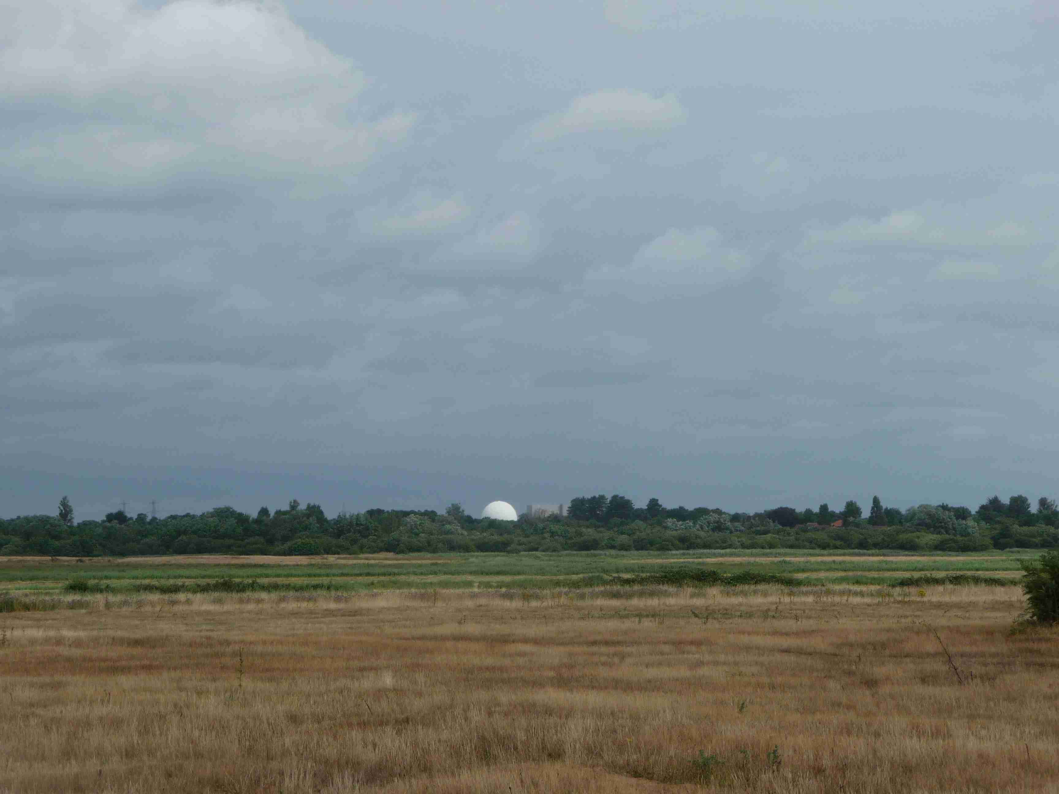
We walk across the path to the sea wall. Aldeburgh lies to the south, Thorpeness to the north, and beyond that, we can see the grey block and the enlarged golf ball of the Sizewell nuclear power stations.
The ‘House in the Clouds’ is visible, and this is well photographed, and I don’t photograph it. Avid readers will, of course, recall that Master F. and myself are keen players of crazy golf, and Thorpeness, with its follies, lakes, eccentric buildings ranging from mock tudor to trad modernist, always seems to me to have a very pronounced resemblance to an oversized crazy golf course.


Thorpeness appears to be built on sand, which I’m sure I remember hearing at some point in my life, is not a good idea, but there is a large wall of sand, contained in bags, apparently supporting the coastline at this point. Great for crazy golf.

Coming around a small promontory, the infinitesimally curved coastline, somewhat grandiosely labelled Sizewell Bay, sweeps all the way to Southwold, which sits primly on its own slight seaward-inclined protuberance, lighthouse winking incongruously in the broad daylight. Less prim are the power stations themselves, Sizewell A and Sizewell B, lying to our left as we walk up the beach, looking more compact up close than they do from a distance, and, I am reassured to learn, sitting on ‘stiff London clay’ to a depth of about 60 metres. Perhaps Thorpeness does too.

Readers may remember the scale of public objection to the building of Sizewell B when it was proposed in the 1980s. The resultant public inquiry considered a huge amount of evidence before eventually granting approval for the building of the station. In 2010, the government approved, in principle, the building of a third station –Sizewell C – on the site, developed by the French National Electricity company EDF (Electricities de France).
This effective re-nationalisation of a substantial part of the electricity industry is one of the interesting paradoxes of the political trend, over the past 30 years, to remove public resources from public ownership. When electricity was ‘privatised’, Powergen had replaced the Central Electricity Generating Board, but according to insiders in the industry, never demonstrated a commitment to long-term investment. It is currently run by EDF. James Meek, writing in the LRB in September 2012
‘’In Thatcherite terms EDF was a public sector mammoth that would inevitably be hunted to extinction by the hungry and agile competitors of post-privatisation countries like Britain. The laws of economics said so. And yet the opposite happened. The mammoth thrived, and Britain failed to produce new competitors, agile or otherwise’’

Sizewell beach is extremely busy. There are a cluster of guitar strumming teenagers sitting outside Sizewell Hall, Christian Conference Centre, which neighbours the power stations, and there are many, many dogs. In fact I have not seen dog walking conducted on such a large scale. In other places, I have seen single people, presumably kennel owners, with up to 14 dogs, usually of the same breed. I have seen professional dog walkers, with half a dozen dogs or so. I have a neighbour, Key West, who regularly walks his three dogs despite professing to like neither dogs nor dog owners in general. I have not seen dog walking of the type that is occurring on Sizewell beach, with quite large groups of people and even larger groups of dogs. In the picture below, there seem to be four people with about ten dogs, but I think there were more out of camera shot, and we passed several groups like this. I’m at a loss what to conclude from this other than that people own three or four dogs at a time and hang out with others who own a similar number, but I might be missing a point. Master F. at one point threatens to get engulfed and carried away by the almost tidal momentum of walkers and dogs.

Towards the end of Sizewell Bay, as the beach approaches Dunwich Heath and Southwold, there is a large, reed-covered wetland, the Minsmere Level, now a nature reserve and run by the RSPB. The wetland was originally an estuary that had been drained for farmland by the 20th century, flooded in 1940 to hinder possible invasion. It was taken over by the RSPB in 1947, interestingly, the same year that avocets returned to breed there. Minsmere is a fragile environment which performs a delicate and complicated role in balancing freshwater drainage from the land and protection from inundation from the sea. There are flood protection gates and the Minsmere Drain leads to the Minsmere tidal sluice which discharges water from the main waterways of the levels into the sea. Sluices and drains are a common feature of the east coast, in some places appearing every few hundred yards, but Minsmere sluice is unusually large; it has notices warning of deep water and of underwater structures, the water is diverted through a red-brick bridge, and thunders through a large round chamber,just visible at the top right of the lower picture below, open at the top and from which you can peer into the torrent below as it is discharged into the sea.


We turn to head inland, following the line of the drain towards Eastbridge when we hear a cry behind us. We turn just in time to see Master F.’s feet disappear over the edge of the chamber into the torrent below. We rush back to save him but it is too late, we have a brief glimpse of what might possibly be a blue and orange trekking shoe, but then, it is gone. Master F. appears to have been engulfed and carried away by the almost tidal momentum of the waters, possibly to be discharged into the sea. The Suffolk coast is becoming uncomfortable.


Thank you Unstable.
The silvermud mile was originally an expanding measure, as in ”It’s only seven miles, we’ll be there by two o’ clock”, to be regretted at four o’clock with one mile still to walk.
I detect a note of scepticism which I assume is directed at the figure of 15 miles. This was arrived at as follows;
Suffolk Coastal Path; 11 miles
Diversion to Eastbridge; 2 Miles
Detours and combobulations;.3/4 of a mile
Poetic license; one-and-a-quarter miles
Wow! A cliff hanger and a nail biter in one episode.
This is of course a hazardous combination. Just cliff hanging alone is discouraged in the Dunwich/Covehithe area, but when done in combination it is not for the faint of heart.
I’m pleased to see the re-emergence of the SilverMud Mile. Unlike the Standard Meter, which is kept at constant temperature in a vault in Paris, the SilverMud Mile is stored at room temperature, folded up, in a pint glass in a public house in East Anglia. A fickle measurement it is reknowned for its shrinking with use. A projected route will measure, for example 8 miles before the event, but could easily have stretched to 12 miles after the foot-slogging.