3rd April 2012
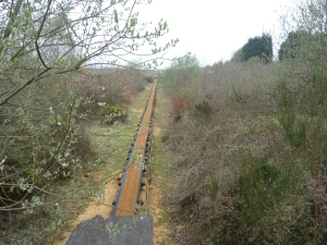
There is a slightly different pattern to our activity as we’re walking for two consecutive days; Ebb Tide and Master F. have stayed at the Silvermud hacienda overnight, and we are continuing the walk from Rowhedge to West Mersea. Crossing the bare concrete apron where the warehouses of Rowhedge Wharf were recently razed to make way for housing, currently in abeyance due to financial collapse of the developer, we follow the Roman River into Fingringhoe, turn left and take the road until we arrive at a footpath through the quarry workings. We are cutting off a corner of the coast here, partly because of the ballast quay, which ships gravel from the quarries (over the past couple of years, providing the foundation for the Olympic site at Stratford), and we pass a working conveyor belt carrying gravel from quarry to quay. A sign assures us that the topsoil from the site is retained and replaced once quarrying is complete and also that the site will not be used for landfill. However, there is currently a local campaign building momentum, in opposition to newly-proposed plans to transport waste from London and to use the quarry as a landfill site.
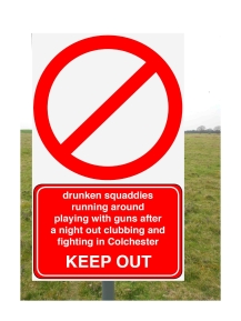
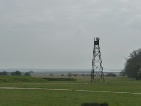
The other obstacle to following the coast exactly is the presence of a military training area and firing range. We’re lucky we can walk this part today; gun fire is part of the soundscape in this area and it’s occurrence is unpredictable, sometimes daily, sometimes, not heard for weeks. The firing times don’t appear to be published, and it’s a matter of chance whether or not you can access the land – when you can’t, red flags appear across a wide area – but as it is, the whole area is eerily quiet and deserted; butts, mock-up buildings, roads, observation towers, surrounded by signs warning you not to touch military debris which could explode and kill you. It evokes a set for an early series of The Avengers, and I could imagine an immaculate John Steed and leather-clad Emma Peel running between the buildings to discover a dead body, represented by a pair of feet hanging suspended in a doorway.
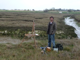
 When we’re through the range, we have a difficult kilometer or so to walk down the Mersea road, busy, fast and with no pavement, before we’re back on the more comfortable terrain of sea wall, which loops around the saltmarsh bringing us to The Strood, the causeway that links Mersea Island to the mainland.The Strood passes over the width, a couple of hundred yards, of the Pyefleet/Strood channels, which, depending on the tide, range between a broad expanse of mud, with a tiny channel threading through it, to a broad sheet of water, with a depth mostly less than a meter, but concealing some deceptively deep channels. At high tide, the water is often irritated by swarms of small boys on jet skis, however, it is low tide as we cross, and a good place to consider the way in which land, sea and sky exist here in shifting dialogue. As we cross The Strood and walk along the seawall towards West Mersea, we find someone doing precisely that. We are approaching a couple of people who appear to be setting up a curious device that looks like a cross between a surveying device and an artist’s easel and which turns out to be a French Easel – actually a cross between an easel and a large paintbox, specifically designed for painting and carrying materials in the field. The artist who explains this to us,Graham Webber, also tells us he is preparing for an exhibition at the nearby Artcafe, and is working on a series of scenes depicting the changing sky over the same area of salt marsh and creek. This is a timely reminder that the Essex littoral, being flat and in a particularly ambivalent relation with the sea, is dominated by the sky, which governs the appearance of the land and seascape, and that the estuarine surface reflects minutely every change in the light. Graham’s work can be seen at;
As the coast constantly merges with, and re-emerges from, the sea, so the population of this part of Essex exists in continuous interaction with London. As, for example, Jaywick might be caricatured as old East Ham, so West Mersea can be redolent of Romford. It’s unsual to hear a rural Essex accent on the coast; inland, it’s common enough, but not here, for since the railway, Londoners have flocked to this coast for a get-away (and still do; the population of St Osyth apparently increases from 1,500 to 7,000 people during the summer), and it’s understandable that people want to stay or retire here. Some people characterise this as an invasion, but being London Essex myself, I prefer to see an element of social osmosis within it, which could be naïve, as something seems to happen to the migratory population when they leave London. I would think of East London as traditional Labour political territory, but the Essex coast seems to breed a particularly virulent kind of hard Conservatism.
Continuing on towards West Mersea, we pass a long stretch where there seems to be an attempt to build the saltmarsh by fencing in the mud (Advancing the Line – the most infrequent of the coastal management strategies) and at this stage, having done two consecutive days walk, as well as a having had a fairly strenuous planning session the previous evening, Master F., Ebb Tide and myself are beginning to feel the burn, so, in the best athletic tradition, we gladly collapse into a pub to recover over a couple of the Mersea Island brewery’s best. We’re undecided about the next stage, wanting to avoid the island on bank holiday weekend, and deciding to bracket our circumnavigation for a later date. We’re also concerned about the route from The Strood to Salcott-Cum-Virley; no right of way, and five wide breaches in the sea wall. We wonder whether or not we can access Ray Island, and, although a woman near the bus stop assures us that we can, she hasn’t done it herself, and I fear that it may be accessible in the same way that Alresford Creek is fordable.
We travel by bus back towards Colchester, with the idea of getting off before the town and cutting across to where the car has been left at Rowhedge. There are more army firing grounds here, the Middlewick Ranges, and we need to take the road that runs across them; this time, unlike earlier at Fingringhoe Wick, the red flags are flying and there is a metal gate across the road, firmly blocking our way. The diversion is too far for us to walk, there’s no bus for half an hour, there’s a pub down the road where we could wait, but we don’t fancy it, so, encouraged by the fact that there is no sound of gunfire and by the sight of a dog walker well within the red flag area, we strike through a gap in the hedge and back onto the lane. It is peaceful and deserted; we walk quite fast on the assumption that if we’re going to get chucked off, we want it to be at the end we’re heading for. Just as we approach the gate at the far end, we are overtaken by a van – the contractor who’s job is to open and close the gates and raise/lower the red flags – “Have you just walked down the lane?” he asks as we pass through the gate. We reply, politely, in the affirmative; “Well”, he declares baldly, “if you want to get killed, it’s up to you.”
