23rd October 2013
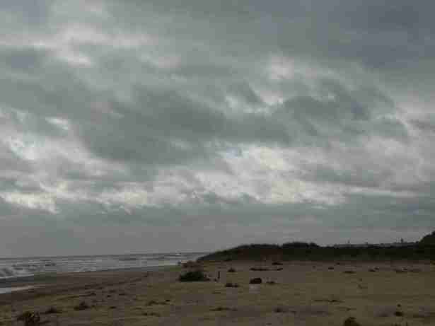
The weather looks as if it could do anything – heavy grey sky threatens rain, but the cloud is moving fast revealing flashes of blue sky and sunshine. Ebb Tide, Master F. and myself set off from Covehithe, southward down the footpath that leads through the dunes to the beach, intending to turn back north along the beach towards Lowestoft. Along the footpath, we note the changes in the pig farm since we were last here back in September. The pigs have been moved to a whole new field which they appear to be efficiently tailoring to suit their wallowing and nesting requirements. The previous field looks as if it is being prepared for cultivation. The pigs will be blissfully unaware of the rate at which the land is receding from the sea in the direction of their homes, but then, I guess the pigs are fairly short-term tenants and not over-concerned about living on one of the fastest-receding stretches of shoreline in the world, or, as The Crown Estate puts it; ‘Historic and contemporary coastal retreat rates here are among the highest found globally as well as within the UK.”
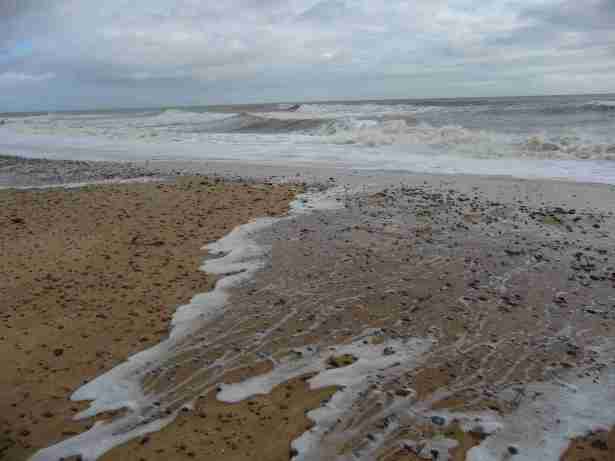
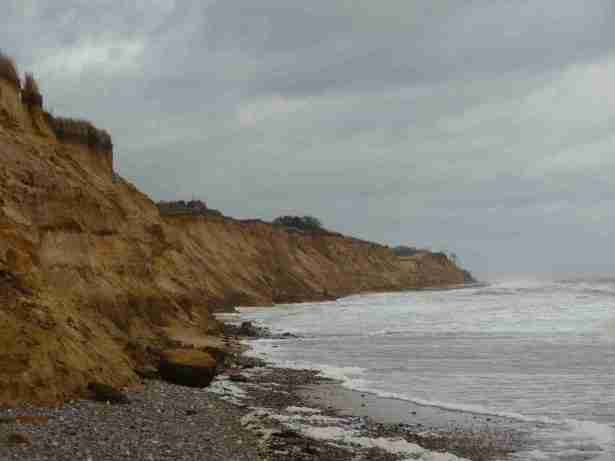
Marsh Samphire and myself came here a few weeks ago, and were reading newspapers on the sand in hot sunshine. People were bathing. Now, the sea is agitated – not a big sea, but relentlessly churning. The low cliffs protect us from the wind coming off the land. The tide is on the flow, incoming water forms a wide rivulet at our feet, leaving a dune between it and the sea, which is about to be submerged. The cliffs are collapsing, which is not reassuring, because I’m concerned at the rate the tide is moving and looking for potential exit routes from the beach, just in case, and these cliffs do not look as if they would support any sort of climbing weight at all. They would be more likely to crumble and precipitate a body back into the sea.
We’re not far along the beach when we round a head, and surveying the small bay beneath Covehithe, the sea is crashing full into the base of the cliffs and it is obviously not going to be a viable route. We ask a dog walker if she knows when high tide is for it might be possible that the water will recede in half an hour or so. She is not sure. It could on the other hand be an hour and a half, and the weather is not right for tarrying on the beach. Advice. If you wish to walk along CovehitheBeach, check your tide table beforehand.(Most people wouldn’t even dream of setting off to walk a tidal beach without doing this first. Ed.)
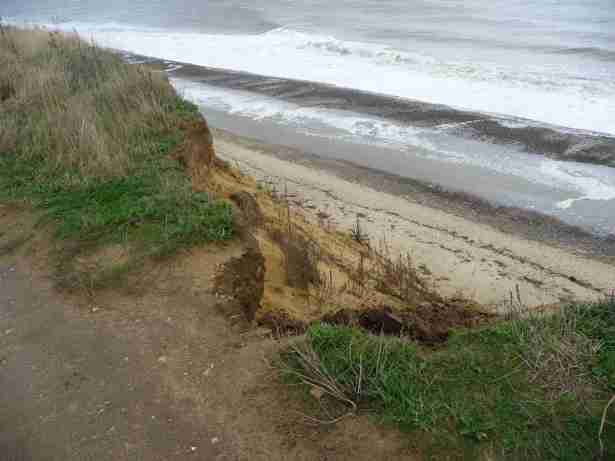
Our reconsidered route takes us along the tops of the cliffs towards Benacre Broad and rainwater run-off from the fields has created large fissures and fractures eating into the tops of the bluff and the footpath as the cliff subsides and granulates back to sand.
Benacre Broad itself is separated from the sea by the merest hint of a sliver of a sandbar, which is breached during tidal surges, thus rendering the broad itself saline. There is a poignant film, made by a local video group, here. The film shows a tidal surge in 2011 when the shingle bank was breached (although today, we are able to walk along the bank at high tide with no problem).
Beyond Benacre Broad and the path takes us along the cliff edge. There was no cliff line here at all until 1981, rather a gradually descending warren which over the years has been subsumed to the sea. One of the wonders of aerial photography is its ability to clarify, depict and prettify coastal eccentricities. Comparing aerial photos over the years is also one of the ways in which coastal erosion has been monitored since the 1940s, both scientifically and journalistically, however, low-lying and deliquescent coasts do not yield their secrets easily. Just as, from a walkers-eye view, what appears to be a level expanse of firm ground can prove to be laced with creeks and drains or atopped by meres and lagoons, so even a birds-eye perspective is partial. Benacre Ness for example, above which we are walking, defies the general southward mobility of the coast by consistently moving northward, and one theory about this is that shingle gets deposited on the north side and washed away on the south. Geologists debate this however, for whilst past erosion can be accurately tracked, and future erosion can in general be confidently anticipated, the precise location and extent of erosion is a less exact science. Much depends on the volume of land that is washed into the sea, the effect this has on the existing sea bed, and the durability of the dry land that is left exposed to further action of the sea. Safe to say however,that the places from where I took at least the first four pictures that illustrate this post, will be ocean floor in 100 years time. Masterly understatement from the Crown Estate again; ‘’Coastlines delimit a highly dynamic boundary line between terrestrial and marine environments’’
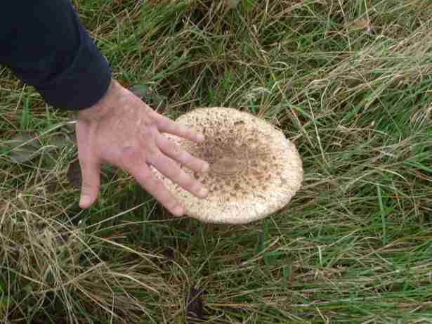
Master F. discovers a pair of generously proportioned parasol mushrooms, larger than the span of his hand, which we photograph in order to impress Secret Informant. Further along still, we are nearly blown off the edge of the cliff by the reverberations of an exceptionally loud bird scaring gun. Interestingly, although we received a severe shock, a flock of a hundred or more Brent Geese fifty yards away are completely unpeturbed by the percussion and remain resolutely grounded. Had Secret informant been with us, he would surely have speculated that the geese were completely knackered having just landed after a long flight from Siberia, and it would take more than a bird-scarer to scare them. The appearance over the brow of a hill ahead, of a man bearing down on us wearing hi-vis clothing does the job that the gun didn’t, and sends the flock aloft in a tumult. The man is carrying what looks like a theodolite with a kind of radar device on it, and sure enough, a quarter of a mile along, there is another HV-clad figure in a surveyor-like posture peering into an eyesight atop a similar piece of equipment. Obviously, GPS enables surveyors to align their poles (or as they are now called ‘total stations’) over long distance. No prizes I suppose, for guessing what it is they are surveying.
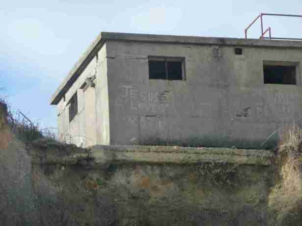
Past the Kessingland pumping station, which marks the mouth of the Hundred River, and on towards Kessingland itself. The cliffs are higher, and there is a broad stretch of grassland offering protection from the sea. The path takes us inland, and we come across Rider Haggard Lane, which reminds us of Kessingland’s diverse political and literary history. Rider Haggard owned a house here, from which Rudyard Kipling, a regular visitor, after a particularly rich meal, allegedly saw a giant serpent writhing in the GermanSea, possibly the result of a surfeit of colonial irrigation. In the mid-20th century, Kessingland was the site of young socialist camps, helping to incubate the Sparticists and the International Socialists in the late 50s and early 60s. Beyond Kessingland, we are back down to the beach narrower now, shingly, underneath crumbling cliff. Lowestoft is ahead of us, and the cliffs are taller, although still crumbling. There is a military bunker perched on the edge of the cliff which looks as if it is unlikely to last the winter at that height, even with divine assistance. Master F. speculates whether he could find a bookie who would take a bet on the date of its collapse.
Its name apparently derived from the Viking Hlothver Toft (Hlothver’s homestead), Lowestoft has a coastal profile dominated by the highest wind turbine in the country, and by the five storey block outline of the renewable energy centre on Lowestoft Ness. The Ness is the most easterly point of the UK., and marks a significant bulge in the broad north-east to south-west line of the Suffolk coast. As such, it plays a significant role in the pattern of erosion on this coast, being both simultaneously vulnerable and a source of protecton to other parts of the coastline.
The energy centre on the Ness has been built in anticipation of flooding in the area. The same cannot be said of Pakefield village, which, whilst in a relatively stable condition now, has not always been so.
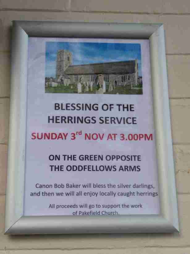
Pakefield is mentioned in the Domesday Book, and at that time it was liable for a tax of 600 herring, and herring are celebrated in the village to this day.
The mid-afternoon has given over to sunshine, and seeing an appropriate place to stop, we do.
